First Edition available here!
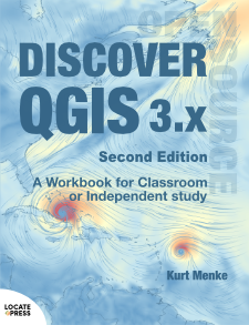
Discover QGIS 3.x - Second Edition
A Workbook for Classroom or Independent Study
by Kurt Menke
Explore the latest Long Term Release (LTR) of QGIS with Discover QGIS 3.x!
A comprehensive updated workbook built for both the classroom and professionals looking to build their skills.
This second edition is a major update to the original Discover QGIS 3.x title published in 2019. Since 2019, there have been 10 new QGIS releases, three of which were long-term releases. It is designed to be used in a classroom setting or by GIS professionals looking to build their skills.
It introduces the QGIS interface and covers: basic GIS concepts, spatial analysis, modeling, data creation and editing, cartographic design and data visualization.
With improved processing, streamlined workflows, support for point cloud data, development of the Temporal Controller, and improved symbology options, it is an exciting time to be learning QGIS!
The improvements in QGIS 3.x allows this Second Edition of Discover QGIS 3.x to be roughly the same length as its predecessor and cover many more features.
You will find clear learning objectives and a task list at the beginning of each chapter. Of the 31 exercises in this workbook, 7 are new and 8 have seen considerable updates. All exercises are updated to support QGIS 3.26.
Among the 500 new screenshots, this edition includes new figures showing the layout of each GUI. There are also more thorough descriptions of many features, for instance, blending modes.
This book has five parts and 424 pages:
- Introduction to Geospatial Technology
- Spatial Analysis
- Data Acquisition and Management
- Cartographic Design
- Advanced Data Visualization
Exercises include:
- An Introduction
- List of tasks
- A list of clear learning objectives
- Helpful tips
- Solution files
- Discussion questions
- Challenge exercises
What's new in this edition
- Updated to QGIS 3.26
- Seven new exercises:
- Raster Data Analysis
- Field Data Collection
- Using the Style Manager & Working with Legend Patch Shapes
- Automating Print Layouts with Templates and Atlases
- Working with Labels and Annotation
- Animating Data with the Temporal Controller
- Working with Point Cloud Data
- Many new tasks in existing chapters:
- Computing Network Isochrones
- Geocoding Using the Nominatim Geocoding Service
- Using Layer Notes
- Applying Layer Effects at the Class Level
- Creating Elevation Profiles with DEM & Point Clouds
- Updated Appendices:
- Coordinate Reference Systems
- Keyboard Shortcuts
- Useful Plugins
- Getting Involved
The book helps you find the information you need for particular tasks using:
- Cross referenced chapters
- Clear learning objectives for exercises
- Updated graphics for QGIS GUI components
- Fuller explanations for many features
- A more thorough Index making it easy to find features
For questions regarding this book, please contact: [email protected]
To keep up to date on Discover QGIS 3.x and our other books, subscribe to our low-volume newsletter.
Discover QGIS - Errata
Will be updated when issues are found. Contact us to report errors.
Contents
To see what's included in the book, download the Table of Contents (PDF).
Availability
- Released August 2022
- The First Edition of Discover QGIS 3.x is still available.
Ordering Information
Our paperbacks can be ordered from Amazon or Ingram. E-books (PDF) can be ordered and downloaded directly from our Purchase E-books page.
If you need multiple print copies of our titles, contact us directly to place an order and save up to 20% when you purchase five or more copies. We print in, and ship from USA, UK, and Australia, but can deliver almost anywhere.
To get a quote and/or place an order, please contact us for details. Before you order, please read our Return Policy.


