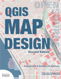
QGIS Map Design - Second Edition
by Anita Graser and Gretchen N. Peterson
With new and updated workflows for QGIS 3.4+!
Learn how to use QGIS 3 to take your cartographic products to the highest level.
QGIS 3.4 opens up exciting new possibilities for creating beautiful and compelling maps!
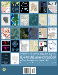
Building on the first edition, the authors take you step-by-step through the process of using the latest map design tools and techniques in QGIS 3. With numerous new map designs and completely overhauled workflows, this second edition brings you up to speed with current cartographic technology and trends.
See how QGIS continues to surpass the cartographic capabilities of other geoware available today with its data-driven overrides, flexible expression functions, multitudinous color tools, blend modes, and atlasing capabilities. A prior familiarity with basic QGIS capabilities is assumed. All example data and project files are included.
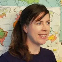
Written by two of the leading experts in the realm of open source mapping, Anita and Gretchen are experienced authors who pour their wealth of knowledge into the book.
Get ready to launch into the next generation of map design!
You can provide feedback on the book's discussion page.
Contents
- Layer Styling
- Applying Graduated Symbol Sizes
- Creating Shapeburst Fills
- Designing Choropleths
- Mapping Economy and Income Using Bivariate Choropleths
- Customizing SVG Files for Color Control
- Highlighting Areas with Inverted Polygons
- Creating Shiny Maps with Color Blending
- Working With Scale
- Generating Cloudy Masks
- Styling Road Maps
- Designing a Value by Alpha Map
- Visualizing Global Connections
- Illuminating Contours Tanaka-Style
- Labeling
- Configuring Label Expressions and Leader Lines
- Text Buffering and Label Placement Options
- Designing Label Hierarchies
- Creating Multi-Attribute Labels and Spatial Filters
- Placing Labels by Hand
- Creating Data-defined Labeling for Road Maps
- Handling Long Label Text Using Substitution
- Creating Curved Area Labels
- Configuring Advanced Halos
- Mastering Rule-based Labels and Project Variables
- Print Map Design
- Learning Layout Basics with the Seattle Coffee Map
- Customizing Legends
- Adding a Gradient Legend
- Mixing Different CRS in One Layout
- Adding Overview Maps and Graticules
- Generating Map Series with Atlas
- Designing Infographics
- Creating Dynamic Masks and Small Multiples
- Mastering Rotated Maps
- Creating Automated Reports
To keep up to date on all our books, subscribe to our low-volume newsletter.
Ordering Information
Our paperbacks can be ordered from Amazon or Ingram. E-books (PDF) can be ordered and downloaded directly from our Purchase E-books page.
If you need multiple print copies of our titles, contact us directly to place an order and save up to 20% when you purchase five or more copies. We print in, and ship from USA, UK, and Australia, but can deliver almost anywhere.
To get a quote and/or place an order, please contact us for details. Before you order, please read our Return Policy.


