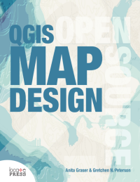
QGIS Map Design
by Anita Graser and Gretchen N. Peterson
Learn how to use QGIS to take your cartographic products to the highest level.
With step-by-step instructions for creating the most modern print map designs seen in any instructional materials to-date, this book covers everything from basic styling and labeling to advanced techniques like illuminated contours and dynamic masking.
See how QGIS is rapidly surpassing the cartographic capabilities of any other geoware available today with its data-driven overrides, flexible expression functions, multitudinous color tools, blend modes, and atlasing capabilities. A prior familiarity with basic QGIS capabilities is assumed. All example data and project files are included.
Written by two of the leading experts in the realm of open source mapping, Anita and Gretchen are experienced authors who pour their wealth of knowledge into the book.
Get ready to bump up your mapping experience!
Be sure to download the Project and data files for the book (URL can be found in Getting Started).
Sample Chapter: Mapping Economies Using GDP Choropleths or Scaled Symbols
Contents
- Styling Layers
- Hillshade, Contour Lines & Hypsometric Tinting
- Graduated Symbol Sizes
- Choropleth Map
- Custom SVGs
- Shapeburst Fill Effects
- Highlighting Areas
- Bivariate Choropleth
- Color Blending
- Styling OSM Roads Like Google Maps
- Value-by-Alpha Maps
- Data-defined Styling: Color Ramp Expressions
- Visualizing Global Connections
- Illuminated Contours
- Labeling
- Labels for Curvy Lines
- Labeling Only Features with Certain Attribute Values
- Text Buffers
- Multi-line Labels
- Typecase & Letter Spacing
- Hand-placed Labels
- Data-defined Labeling Expressions & Merging Connected to Avoid Duplicates
- Label Priority
- Curved Area Labels
- Print Layouts
- Layout Basics
- Customized Legends
- Adding a Gradient Legend
- Aesthetic Scalebars
- Graticules
- Overview Maps
- Working with Scale
- Attribute Tables
- Map Series with Atlas
- Infographics
- Dynamic Masks for Small Multiples
For questions regarding this book, please
contact: [email protected]To keep up to date on QGIS Map Design and our other
books, subscribe to our low-volume newsletter.
Ordering Information
Our paperbacks can be ordered from Amazon or Ingram. E-books (PDF) can be ordered and downloaded directly from our Purchase E-books page.
If you need multiple print copies of our titles, contact us directly to place an order and save up to 20% when you purchase five or more copies. We print in, and ship from USA, UK, and Australia, but can deliver almost anywhere.
To get a quote and/or place an order, please contact us for details. Before you order, please read our Return Policy.


