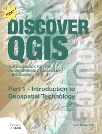
Discover QGIS: Part 1 - Introduction to Geospatial Technology
by Kurt Menke
Get a great introduction to Geospatial Technology with Part 1 of Discover QGIS.
This book contains the first part of Discover QGIS and gives you a great introduction to geospatial technology.
The curriculum is based on a national standard--the U.S. Department of Labor's Geospatial Competency Model--a hierarchical model of the knowledge, skills, and abilities needed to work as a GIS professional in today's marketplace.
Originally written for QGIS v2.4, the material in this workbook has been updated for use with QGIS v2.14, Inkscape v0.91, and GRASS GIS v7.0.3. This is the most up-to-date version of the GeoAcademy curriculum. To aid in learning, all exercise data includes solution files.
Detailed Table of ContentsTopics
- Spatial Data Models
- Explore and understand geospatial data models
- Working with the QGIS Browser
- Viewing geospatial data in QGIS Desktop
- Displaying Geospatial Data
- Creating a map based on customer requirements
- Adding and organizing map layers
- Styling data layers
- Composing a map deliverable
- Creating Geospatial Data
- Creating a new shapefile
- Transforming coordinate systems
- Heads-up digitizing
- Understanding Remote Sensing and Analysis
- Basics of using QGIS Desktop for image analysis
- Display and inspection of image data
- Unsupervised classification
- Basic Geospatial Analysis Techniques
- Using spatial analysis to solve a problem
- Obtaining needed data
- Querying and extracting subsets of data
- Working with coordinate reference systems
- Dissolving boundaries
- Buffering and clipping data
- Preparing a map of results
For questions regarding this book, please contact: [email protected]
To keep up to date on Discover QGIS and our other books, subscribe to our low-volume newsletter.
Ordering Information
Our paperbacks can be ordered from Amazon or Ingram. E-books (PDF) can be ordered and downloaded directly from our Purchase E-books page.
If you need multiple print copies of our titles, contact us directly to place an order and save up to 20% when you purchase five or more copies. We print in, and ship from USA, UK, and Australia, but can deliver almost anywhere.
To get a quote and/or place an order, please contact us for details. Before you order, please read our Return Policy.


